Introduction
Manaslu Circuit with Tsum Valley Trek Overview
The Manaslu Circuit with Tsum Valley Trek is widely recognized as one of Nepal’s most rewarding off-the-beaten-path adventures. Situated in the central Himalayas east of the Annapurna range, this expedition centers around Mount Manaslu (8,163 m)—the eighth-highest peak in the world. Derived from the ancient Sanskrit word Manasa, the name Manaslu translates to “Mountain of the Spirit.” Consequently, local mountain communities revere the peak as a compassionate, powerful deity that spiritually guards the surrounding valleys.
Located near the border of Nepal and Tibet, the restricted border zone was officially opened to foreign trekkers only in 1992 AD. Because it remains a government-regulated area, foreign travelers must trek with a licensed guide and secure official permits through an authorized agency like Attractive Travel Nepal. Therefore, the trail has successfully preserved its pristine environment, raw wilderness, and rich cultural heritage from mass commercialization.
By combining the sacred, untouched Tsum Valley with the classic circuit, this 18-day journey introduces you to hidden Tibetan-influenced settlements, centuries-old monasteries (Mu Gompa, Pungyen Gompa), ancient Mani walls, and the historic Milarepa Cave. Furthermore, as you ascend from subtropical river gorges to alpine glacial plateaus, you will encounter remarkable ecological diversity, turquoise glacial waters like Birendra Lake, and rare mountain wildlife.
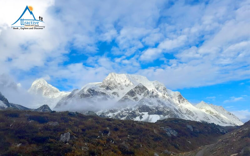
Throughout the trek, adventurers enjoy wide-angle panoramas of majestic Himalayan giants, including Mount Manaslu, Himalchuli, Ngadi Chuli, Simnang Himal, Peak 29, and the Ganesh Himal massif. Ultimately, the physical climax of the expedition is crossing the thrilling Larkya La Pass (5,106 m).
Route & Travel Logistics
-
Starting Point: Your journey begins with a scenic drive from Kathmandu to Machha Khola, following the Budhi Gandaki River valley upward into the restricted area.
-
Tsum Valley Detour: Afterward, the trail branches off northeast into the sacred valley at Lokpa, exploring ancient monasteries up to Mu Gompa (3,700 m) before rejoining the main circuit route.
-
The High Pass: After acclimatizing at Samagaon and Samdo, you cross the legendary Larkya La Pass (5,106 m), which rewards you with front-row views of Himlung Himal, Cheo Himal, and Annapurna II.
-
Ending Point: Descending into the Marsyangdi River valley at Tilche, you drive down to Besisahar. From there, you return via private vehicle to Kathmandu or Pokhara.
-
Best Trekking Seasons: The ideal months for this trek are Spring (March to May) for blooming rhododendron trails and warm weather, or Autumn (September to November) for crystal-clear mountain views.
Key Highlights of the Journey
-
The Hidden Tsum Valley: Explore the sacred “Beyul” valley, rich in ancient Tibetan Buddhist tradition, heritage monasteries (Mu Gompa, Pungyen Gompa), and the historic Milarepa Cave.
-
Panoramas of Himalayan Giants: Enjoy close-up vistas of Mount Manaslu (8,163m), Ganesh Himal, Himlung Himal, Annapurna II, and Peak 29.
-
Larkya La Pass (5,106m): Challenge yourself with an exhilarating high-altitude crossing offering sweeping views of massive glaciers and alpine peaks.
-
Rich Tibetan Culture: Experience authentic mountain lifestyle, ancient Mani walls, traditional stone villages, and local hospitality in Nupri and Tsum regions.
-
Diverse Landscapes: Travel from sub-tropical river gorges and waterfall-draped valleys to high alpine glaciers and wind-swept Himalayan plateaus.
-
Tailored Adventures: You can also explore our other popular routes like the classic Annapurna Circuit Trek or the iconic Everest Base Camp Trek.
Frequently Asked Questions (FAQs) About Manaslu Circuit with Tsum Valley Trek
1. What makes the Tsum Valley addition unique compared to the standard circuit?
The Tsum Valley is a sacred, hidden Buddhist valley (known as a Beyul) located near the Tibetan border. By adding this region to the Manaslu Circuit with Tsum Valley Trek, trekkers experience deeply preserved Tibetan culture, ancient monasteries like Mu Gompa, and the famous Milarepa Cave. Furthermore, it adds rich cultural immersion and extra acclimatization days before crossing Larkya La Pass.
2. How difficult is the 18-Day Manaslu with Tsum Valley Trek?
Overall, this combined trek is classified as strenuous to challenging. Because you will be trekking for 18 consecutive days over rugged mountain paths, daily walking averages 5 to 7 hours. However, the physical climax of the trip is crossing Larkya La Pass (5,106 m), which requires good stamina, mental determination, and solid endurance.
3. Can I trek to Tsum Valley and Manaslu solo without a guide?
No, solo trekking is strictly illegal in both regions. Because both the Tsum Valley and Upper Manaslu are designated as restricted border zones, the Government of Nepal Department of Immigration mandates that foreign trekkers must:
-
Trek in a group of at least two foreign nationals.
-
Be accompanied by an official, licensed Nepali trekking guide.
-
Secure all mandatory Restricted Area Permits through a registered agency.
4. What permits do I need for the Manaslu Circuit with Tsum Valley Trek?
Because this route enters multiple protected and restricted areas, you will need five official permits:
-
Tsum Valley Restricted Area Permit (RAP)
-
Manaslu Restricted Area Permit (RAP)
-
Manaslu Conservation Area Permit (MCAP)
-
Annapurna Conservation Area Permit (ACAP)
-
TIMS Card (Trekkers’ Information Management System)
For more details on rules, check out our guide on Nepal Trekking Permits & Regulations.
5. How is altitude sickness managed on this 18-day itinerary?
Our carefully designed itinerary includes multiple gradual ascents and dedicated rest/acclimatization days at Samagaon (3,520 m) and Samdo (3,860 m). Additionally, side hikes to Manaslu Base Camp (4,800 m) and the Rui La / Tibetan Border (4,998 m) follow the “climb high, sleep low” rule. As a result, your body gets ample time to adapt safely before tackling the high pass.
6. What are the lodge facilities like in the Tsum Valley and Manaslu regions?
While lower villages offer comfortable teahouses with hot showers and Wi-Fi, accommodation in the Tsum Valley and high camps (like Dharamshala) is more basic. Rooms are simple twin-sharing setups with wooden beds and blankets. Therefore, carrying a reliable -15°C rated sleeping bag is highly recommended for cold mountain nights.
7. What type of food is served during the trek?
Teahouse menus offer a nutritious mix of local and international dishes:
-
Nepali Fuel: Dal Bhat (rice, lentil soup, and vegetable curry)—an all-you-can-eat favorite for high-energy days.
-
Local Specialties: Sherpa stew (Shyakpa), Tibetan bread, momos, and hot noodle soups (Thukpa).
-
Western Options: Porridge, pancakes, eggs, fried rice, pasta, and pizza choices.
8. What is the best season to do this combined trek?
-
Autumn (September to November): Offers stable post-monsoon weather, comfortable temperatures, and crystal-clear views of the snow-capped Himalayan peaks.
-
Spring (March to May): Features warmer days, clear morning views, and lush blooming rhododendron trails across the lower valley.
-
Note: Winter brings heavy snow that closes the high pass, while the summer monsoon season brings heavy rain and landslides. Learn more about optimal timing on the official Nepal Tourism Board portal.
9. Is emergency evacuation available if needed?
Yes. In the event of severe Acute Mountain Sickness (AMS) or physical injury, your lead guide will coordinate a helicopter rescue. However, trekkers must carry personal travel insurance that explicitly covers high-altitude trekking (up to 5,500 meters) and emergency medical evacuation. You can review our Essential Travel Insurance Tips before booking.
Itinerary
Day 1: Scenic Drive from Kathmandu to Machha Khola
your grand adventure begins with an early morning pickup from your hotel in Kathmandu. Setting off in a private 4WD vehicle, the route heads west along the winding Prithvi Highway before branching off toward the Budhi Gandaki River valley. Along the way, you will pass through vibrant market towns, rural farmland, and terraced hillsides. As the paved road transitions into a winding mountain track, the surrounding landscapes become increasingly dramatic. Finally, after a full day of scenic travel, you will reach the bustling riverside settlement of Machha Khola to settle into your lodge.
-
Location: Machha Khola
-
Elevation: 869 meters / 2,851 feet
-
Distance: 160 km / 99.4 miles
-
Drive Time: 9–10 hours
-
Accommodation: Teahouse / Lodge
-
Meal Plan: Breakfast, Lunch, and Dinner (BLD)
Day 2: Trek from Machha Khola to Jagat
Following a hot breakfast, the foot portion of your journey officially commences along the banks of the Budhi Gandaki River. The trail meanders through narrow gorges, crossing several suspension bridges festooned with prayer flags. You will pass the natural hot springs at Tatopani before ascending over a steep ridge and continuing through small local hamlets. After navigating lush riverbed trails and stone steps, a final steady climb leads to the neat, stone-paved village of Jagat, which serves as the entry checkpoint for the restricted area.
-
Location: Jagat
-
Elevation: 1,340 meters / 4,395 feet
-
Distance: 22 km / 13.7 miles
-
Trek Time: 6–7 hours
-
Accommodation: Teahouse / Lodge
-
Meal Plan: Full Board (BLD)
Day 3: Trek from Jagat to Lokpa
Leaving Jagat, the pathway descends to the riverbed before climbing up to the terraced village of Salleri. From here, sweeping views of Shringi Himal open up as you trek onward to Sirdibas and Philim. After completing permit checks in Philim, the trail leaves the main circuit route and veers northeast into dense bamboo and pine forests. Crossing the Budhi Gandaki once more, a sustained uphill walk brings you to Lokpa—the secret gateway to the hidden Tsum Valley.
-
Location: Lokpa
-
Elevation: 2,240 meters / 7,349 feet
-
Distance: 17 km / 10.6 miles
-
Trek Time: 6–7 hours
-
Accommodation: Teahouse / Lodge
-
Meal Plan: Full Board (BLD)
Day 4: Trek from Lokpa to Chumling
A shorter hiking day allows you to adjust to the rising altitude while penetrating deeper into the Tsum region. The path descends through dense rhododendron and conifer woodlands into the Syar River gorge. Crossing a suspension bridge, the route climbs steadily along a cliffside trail offering views of the Ganesh Himal range. Eventually, the valley opens up to reveal Chumling, a charming Lower Tsum village complete with traditional stone houses and historic gompas.
-
Location: Chumling
-
Elevation: 2,386 meters / 7,828 feet
-
Distance: 7 km / 4.3 miles
-
Trek Time: 4–5 hours
-
Accommodation: Teahouse / Lodge
-
Meal Plan: Full Board (BLD)
Day 5: Trek from Chumling to Chhokangparo
Stepping onto the trail, you cross the Syar River and enter the broad, flat valley floor of Upper Tsum. The scenery transforms dramatically into arid, Tibetan-style landscapes dotted with ancient chortens, long Mani walls, and agricultural fields of barley and buckwheat. Passing through the quiet settlements of Rainjam and Serpu, a final climb brings you to Chhokangparo. Here, you are greeted by warm local hospitality and front-row views of the Ganesh Himal massif.
-
Location: Chhokangparo
-
Elevation: 3,031 meters / 9,944 feet
-
Distance: 11 km / 6.8 miles
-
Trek Time: 5–6 hours
-
Accommodation: Teahouse / Lodge
-
Meal Plan: Full Board (BLD)
Day 6: Trek from Chhokangparo to Mu Gompa via Milarepa Cave
Heading further up the valley, the morning trail passes through tiny Tibetan hamlets like Burji and Nile. Along the route, a short side excursion leads to the historic Milarepa Cave (Piren Phu), where the legendary saint Milarepa is believed to have meditated centuries ago. Continuing along the riverbed, the valley narrows before ascending to Mu Gompa—the highest permanently inhabited monastery in the Tsum Valley, perched beneath towering glacier peaks.
-
Location: Mu Gompa / Nile
-
Elevation: 3,700 meters / 12,139 feet
-
Distance: 13 km / 8.1 miles
-
Trek Time: 6–7 hours
-
Accommodation: Teahouse / Lodge
-
Meal Plan: Full Board (BLD)
Day 7: Trek from Mu Gompa / Nile back to Chumling
After exploring the ancient relics and shrines around Mu Gompa during sunrise, the return journey down the valley begins. Because the trail descends steadily, you will make fast progress back through Chhokangparo and Nile. Enjoying fresh perspectives of the Ganesh Himal and Buddha Himal peaks, the path retraces its steps back to the lush green environment of Chumling for a restful evening.
-
Location: Chumling
-
Elevation: 2,386 meters / 7,828 feet
-
Distance: 23 km / 14.3 miles
-
Trek Time: 7–8 hours
-
Accommodation: Teahouse / Lodge
-
Meal Plan: Full Board (BLD)
Day 8: Trek from Chumling to Deng
Bidding farewell to the Tsum Valley, the trail drops down to Lokpa before reconnecting with the main Budhi Gandaki River canyon. You will navigate a dramatic gorge section carved into steep rock faces, crossing multiple suspension bridges high above the rushing river. Passing through dense bamboo, fir, and oak forests, the path reaches the small village of Deng, signaling your return to the main Manaslu Circuit.
-
Location: Deng
-
Elevation: 1,860 meters / 6,102 feet
-
Distance: 17 km / 10.6 miles
-
Trek Time: 6–7 hours
-
Accommodation: Teahouse / Lodge
-
Meal Plan: Full Board (BLD)
Day 9: Trek from Deng to Namrung
Starting out from Deng, the trail crosses the Budhi Gandaki River and ascends through lush forests toward Rana and Bhi villages. As you climb higher into the Nupri region, Tibetan cultural influences become increasingly prominent, marked by beautifully carved Mani stones and local prayer wheels. After crossing the river several times over dramatic bridges, a final steep ascent through dense fir woods delivers you to Namrung, a famous gateway village offering panoramic mountain vistas.
-
Location: Namrung
-
Elevation: 2,630 meters / 8,629 feet
-
Distance: 19 km / 11.8 miles
-
Trek Time: 6–7 hours
-
Accommodation: Teahouse / Lodge
-
Meal Plan: Full Board (BLD)
Day 10: Trek from Namrung to Shyala
Glorious morning views of Mount Manaslu, Simnang Himal, and Peak 29 reward early risers in Namrung. Setting off through apple orchards and quiet alpine villages like Lihi and Lho, you will have opportunities to visit local gompas and marvel at traditional Buddhist architecture. Leaving Lho, the trail ascends through pine and rhododendron glades before opening up to the majestic village of Shyala, which boasts 360-degree views of snow-capped Himalayan giant massifs.
-
Location: Shyala
-
Elevation: 3,500 meters / 11,483 feet
-
Distance: 13 km / 8.1 miles
-
Trek Time: 5–6 hours
-
Accommodation: Teahouse / Lodge
-
Meal Plan: Full Board (BLD)
Day 11: Trek from Shyala to Samagaon via Pungyen Gompa
A high-altitude highlight awaits as you embark on a side excursion toward Pungyen Gompa, an ancient monastery situated in a vast glacial amphitheater directly beneath the east face of Mount Manaslu. After taking in the views, you descend back to the main trail and walk across alpine pastures to Samagaon. This large, historic village serves as the cultural center of the upper Nupri region.
-
Location: Samagaon
-
Elevation: 3,520 meters / 11,549 feet
-
Distance: 15.5 km / 9.3 miles
-
Trek Time: 4–6 hours
-
Accommodation: Teahouse / Lodge
-
Meal Plan: Full Board (BLD)
Day 12: Acclimatization at Samagaon (Hike to Manaslu Base Camp & Birendra Lake)
Dedicated rest and acclimatization are essential before tackling higher elevations. The day features a scenic excursion to Birendra Lake, a vibrant turquoise glacial lake located at the foot of the Manaslu Glacier. For those feeling energetic, the hike continues upward along moraine ridges to Manaslu Base Camp (4,800m), where expedition tents gather during climbing seasons. Returning to Samagaon in the afternoon allows plenty of time to rest and recharge.
-
Location: Samagaon
-
Elevation: 3,520 meters / 11,549 feet (Base Camp at 4,800m / 15,748ft)
-
Distance: 14–16 km / 8.7–9.9 miles
-
Trek Time: 7–8 hours
-
Accommodation: Teahouse / Lodge
-
Meal Plan: Full Board (BLD)
Day 13: Trek from Samagaon to Samdo
A relatively short trekking day allows your body to continue adapting smoothly to higher altitudes. Descending to the Budhi Gandaki River, the trail passes long Mani walls before entering birch and juniper woodlands. Crossing a wooden bridge, you climb a dry, wind-swept terrace toward Samdo—a traditional village situated close to the Tibetan border, inhabited primarily by Tibetan refugees.
-
Location: Samdo
-
Elevation: 3,860 meters / 12,664 feet
-
Distance: 8 km / 5 miles
-
Trek Time: 3–4 hours
-
Accommodation: Teahouse / Lodge
-
Meal Plan: Full Board (BLD)
Day 14: Acclimatization at Samdo (Hike to Rui La / Tibetan Border)
Another strategic acclimatization day is spent undertaking a spectacular high-altitude hike to Rui La (4,998m), a high pass on the ancient trade border between Nepal and Tibet. Walking along dry alpine valleys, you will often spot yak caravans and blue sheep grazing on steep ridges. The summit of Rui La yields wide panoramas of the Tibetan plateau and surrounding Himalayan peaks before you return to Samdo for the night.
-
Location: Samdo
-
Elevation: 3,860 meters / 12,664 feet (Rui La at 4,998m / 16,393ft)
-
Distance: 18 km / 11.2 miles
-
Trek Time: 7–8 hours
-
Accommodation: Teahouse / Lodge
-
Meal Plan: Full Board (BLD)
Day 15: Trek from Samdo to Dharamshala (Larkya Phedi)
Leaving Samdo, the trail descends past a ancient market site before crossing a wooden bridge over the headwaters of the Budhi Gandaki. Ascending gradually across glacial moraines, you pass towering ice fields and rugged terrain. The route ends at Dharamshala (Larkya Phedi), a seasonal high camp situated at the base of the pass. Early rest is strongly encouraged in preparation for the pre-dawn pass crossing tomorrow.
-
Location: Dharamshala / Larkya Phedi
-
Elevation: 4,460 meters / 14,633 feet
-
Distance: 6 km / 3.7 miles
-
Trek Time: 3–4 hours
-
Accommodation: Teahouse / High Camp Lodge
-
Meal Plan: Full Board (BLD)
Day 16: Cross Larkya La Pass (5,106m) and descend to Bhimtang
An early pre-dawn start ensures safe passage over the high mountain pass before late-morning winds pick up. The trail climbs steadily across frozen glacial moraines, rock fields, and ridge tops marked by prayer flags. Reaching the summit of Larkya La Pass (5,106m) reveals a vast alpine landscape with views of Himlung Himal, Cheo Himal, Kang Guru, and Annapurna II. After celebrating the pass crossing, a long, careful descent down snow ridges and moraines brings you down to the grassy meadows of Bhimtang.
-
Location: Bhimtang
-
Elevation: 3,590 meters / 11,778 feet (Larkya La at 5,106m / 16,752ft)
-
Distance: 24 km / 14.9 miles
-
Trek Time: 8–10 hours
-
Accommodation: Teahouse / Lodge
-
Meal Plan: Full Board (BLD)
Day 17: Trek from Bhimtang to Tilche and Drive to Besisahar
Descending through alpine pastures, the morning trail passes glacial streams and dense rhododendron, oak, and pine woodlands. Following the Dudh Khola down through Karche and Gho, you eventually arrive at the village of Tilche, marking the official end of your foot trek. From Tilche, you will board a private 4WD jeep for a rugged drive along the Marsyangdi River valley down to Besisahar.
-
Location: Besisahar
-
Elevation: 760 meters / 2,493 feet (Tilche at 2,300m / 7,546ft)
-
Distance: 16 km trek + 43 km drive (9.9 mi trek + 26.7 mi drive)
-
Time: 5–6 hours trek + 3–4 hours drive
-
Accommodation: Hotel / Lodge
-
Meal Plan: Full Board (BLD)
Day 18: Drive from Besisahar to Kathmandu or Pokhara
A comfortable private vehicle drive completes your journey back to civilization. Following the Trishuli and Marsyangdi river highways, you will wind through terraced landscapes, market towns, and rural settlements. Upon arrival in Kathmandu (or Pokhara, depending on your ongoing travel arrangements), you will transfer to your hotel. In the evening, a special farewell dinner featuring live traditional music and cultural dance awaits to celebrate the completion of your expedition!
-
Location: Kathmandu / Pokhara
-
Elevation: 1,400 meters / 4,593 feet (Kathmandu)
-
Distance: 176 km / 109.4 miles (to Kathmandu)
-
Drive Time: 6–7 hours
-
Accommodation: Hotel
-
Meal Plan: Breakfast and Farewell Dinner (BD)
Inclusions
To ensure a seamless and worry-free adventure, our package provides comprehensive services from your initial arrival to your final departure. Specifically, your booking includes the following amenities and services:
Transfers & Transportation
-
Airport Transfers: Private car or vehicle transfers for both your international flight arrival and departure.
-
Ground Logistics: All overland transportation throughout the entire journey as specified in the itinerary.
Accommodation & Meals
-
Kathmandu Stay: Hotel accommodation in Kathmandu provided on a Bed and Breakfast (B/B) basis.
-
Trekking Lodging: Handpicked teahouse and lodge accommodation during the trek.
-
Daily Meals: Full board meals (Breakfast, Lunch, and Dinner) daily along the trekking route.
-
High-Altitude Care: Nourishing hot soup served in high-altitude areas to support proper hydration and warmth.
-
Special Celebrations: Traditional farewell dinner in Kathmandu to celebrate your trip’s completion.
Professional Crew & Support Staff
-
Licensed Trek Guide: Experienced, professional guide for both the trekking route and city tours.
-
Assistant Trek Guide: Dedicated assistant guide provided for groups with more than 10 passengers (pax).
-
Porter Service: Reliable mountain porters provided on a 2:1 ratio (2 trekkers : 1 porter).
-
Staff Welfare: Complete insurance, fair wages, food, and accommodation for all guides and porters.
Permits, Documents & Taxes
-
Official Documentation: All necessary trekking permits, including Restricted Area Permits (RAP) and TIMS cards.
-
Taxes & Fees: All applicable government taxes and local entry fees.
Safety & Trek Equipment
-
Medical Safety: Comprehensive medical first-aid kit carried by the trekking staff.
-
Souvenirs & Extras: Detailed trekking map reflecting the itinerary, a complimentary company T-shirt, and an official trip completion certificate.
Exclusions
While our comprehensive package covers all major operational and logistical expenses, certain personal costs and optional items are not included. Specifically, you will need to plan separately for the following items:
Travel & Entry Documentation
-
Nepal Tourist Visa: Visa fee upon arrival at Tribhuvan International Airport in Kathmandu.
-
International Airfare: International flights to and from Kathmandu.
-
Monument Entrance Fees: Entry fees for heritage sites, temples, and monuments during city tours in Kathmandu.
Insurance & Medical Coverage
-
Personal Travel Insurance: Mandatory high-altitude travel, medical, and emergency helicopter rescue insurance (covering up to 5,500 meters).
Meals & Extra Stays in the City
-
Kathmandu Meals: Lunch and dinner during your stay in Kathmandu (except for the included welcome or farewell dinners).
-
Additional Accommodation: Extra night stays in Kathmandu that fall outside the planned itinerary.
Personal On-Trail Expenses
-
Teahouse Utilities: Charges for hot showers, electronic device charging, and Wi-Fi access along the trail.
-
Beverages & Refreshments: Mineral water, boiled water, soft drinks, alcohol, bar bills, and extra snacks.
-
Personal Services: Laundry fees and personal shopping along the trek.
-
Staff Gratuities: Tips for your trekking guide, assistant guide, and porters (customary in Nepal to show appreciation).
Equipments
1. Clothing
-
Base Layers: Moisture-wicking merino wool or synthetic thermal tops and bottoms to pull sweat away from the skin.
-
Mid Layers: Fleece jacket or fleece pants and wool/synthetic sweaters to trap warmth close to the body.
-
Outer Layers: Waterproof and windproof jacket (windbreaker/raincoat) and rain trousers to protect against snow, heavy wind, and rain.
-
Added (Crucial): Insulated Heavy Down Jacket: High-fill power (-10°C to -15°C rated) for high-altitude stops (Samagaun to Larkya Phedi).
-
Headwear:
-
Sun Hat: Wide-brimmed hat protecting face, neck, and ears from UV rays.
-
Buff / Neck Gaiter: Versatile wrap for UV protection, dust, and cold winds.
-
Added: Warm Beanie / Fleece Hat: Essential for freezing mornings and nights higher up.
-
-
Handwear (Added):
-
Light Inner Gloves: Fleece or liner gloves for mild walking days.
-
Heavy Waterproof / Windproof Gloves or Mittens: Essential for cold conditions at Larkya La Pass.
-
2. Footwear
-
Hiking Boots: Waterproof, supportive boots with good ankle protection and Vibram-style rubber grip.
-
Camp Shoes / Sandals: Lightweight shoes/crocs to rest feet and air out at teahouses.
-
Trekking Socks: 4–5 pairs of merino wool or cushioned synthetic socks + liner socks to prevent blisters.
-
Gaiters: Protective leg covers to keep out mud, gravel, and snow near Larkya La Pass.
3. Sleeping Gear
-
Sleeping Bag: Essential cold-weather sleeping bag rated down to -10°C / -15°C (teahouse rooms are unheated).
-
Light Thin Blanket: Easy to pack extra insulation layer.
-
Inflatable / Compressible Pillow: Compact neck and head support for rest.
-
Sleeping Mask: Keeps out light in shared or bright settings.
-
Ear Pods: Great for relaxing with audio in the evenings.
-
Added: Earplugs: Essential to block out barkings dogs and thin teahouse walls.
4. Backpack & Luggage
-
Main Backpack (50–70 L): For trekkers carrying their own gear, featuring an adjustable harness, padded hip belt, several pockets, and durable ripstop nylon construction.
-
Added: Duffel Bag (70–90 L): Standard waterproof bag provided/used if a porter is carrying your main gear (keep gear within ~10–12 kg per trekker).
-
Added: Daypack (20–30 L): For carrying daily essentials (water, extra layer, camera, passport) while porters carry the duffel.
-
Rain Cover: Waterproof cover for both daypack and main bag.
5. Navigation, Safety & Emergency
-
Map & Compass: Detailed topographic map of the Manaslu Circuit.
-
GPS Device & Navigation Apps: Electronic tracking with offline maps loaded.
-
Guidebook: Trail description and route background.
-
Personal Locator Beacon (PLB) / Satellite Tracker: Emergency signaling in off-grid sections.
-
Altimeter: Altitude tracking via smartwatch or phone.
-
First Aid Kit: Antiseptic, thermometer, ointment, medical spray, cotton, bandages, blister plasters (Compeed), and personal meds.
-
Added (Crucial): Altitude Sickness Medication: Acetazolamide (Diamox) for AMS prevention, ibuprofen/paracetamol, anti-diarrheal tabs, and rehydration salts.
-
Trekking Poles: Reduces stress on knees during long ascents and steep descents.
-
Bad Weather Gear: Outer waterproof shells and insulated accessories.
-
Emergency Shelter / Bivvy Bag / Space Blanket: Compact warmth for unexpected delays.
-
High-Energy Snacks & Water Purification: Energy bars, trail mix, and water purification tablets, Drops, or UV Purifiers (SteriPEN).
6. Personal Items & Hygiene
-
Sunscreen & Lip Balm: High SPF (50+) UV block and lip protection.
-
Toothbrush, Toothpaste & Biodegradable Soap: Environmentally friendly soap for body and clothes.
-
Hand Sanitizer & Toilet Paper: Teahouses do not supply toilet paper.
-
Quick-Dry Towel: Compact microfiber towel.
-
Nail Clippers: Keeps nails trimmed to prevent boot pressure pain.
-
Added: Wet Wipes / Baby Wipes: Essential for “wet-wipe baths” when hot water is unavailable.
7. Electronics & Power
-
Headlamp: Quality torch with extra batteries / USB charging for pre-dawn pass crossings.
-
Smartphone & Camera: For communication, photography, and navigation.
-
Power Bank: High capacity (20,000 mAh+) as teahouses charge fees for electricity.
-
Plug Adapter: Universal or C/D type plug adapter.
-
Chargers, Cables & Extra Memory Cards: Spares for cold-battery drain.
8. Travel Documents & Cash
-
Passport & Nepal Tourist Visa: Valid passport (at least 6 months remaining) and visa.
-
Required Permits:
-
Manaslu Restricted Area Permit (RAP)
-
Manaslu Conservation Area Permit (MCAP)
-
Annapurna Conservation Area Permit (ACAP)
-
Note on TIMS: A TIMS card is not required for the standard Manaslu Circuit unless extending into the full Annapurna Circuit past Dharapani.
-
-
Travel Insurance: Policy documents explicitly covering high-altitude trekking (up to 5,500m) and emergency helicopter evacuation.
-
Passport Photos: 4–6 physical copies for permits/SIM cards.
-
Added: Cash (NPR): Enough local cash (Nepalese Rupees) for personal expenses (teahouse hot showers, charging, extra hot drinks, tips), as there are no ATMs between Arughat/Soti Khola and Besisahar.
Note: If you are missing any equipment or prefer not to pack heavy gear from home, you can easily buy or rent high-quality trekking gear (such as down jackets, sleeping bags, and trekking poles) in the Thamel of Kathmandu prior to departure.
Departure
| Trip Start Date | Trip End Date | Price | Availability | Book |
|---|
Reviews
Rotary proxies
Best Tour and trekking company based in Kathmandu, Nepal. Highly recommend to all for your memorable trip to Nepal.
Beautiful Trip
he time with you in Lang Tang Valley was simply amazing! We saw incredible landscapes and very friendly people!
With our guide on our site, we always felt safe and it was always like we met a good friend!
Thank you very much for the beautiful Time, I will never forget it!
Many greetings from Germany
| Group Size | Group Price |
|---|---|
| 1 | US $ 2195 |
| 2-4 | US $ 1690 |
| 5-10 | US $ 1550 |
| 11-19 | US $ 1460 |
| 20+ | US $ 1390 |